Police fly drone to investigate fatal Fort Collins crash
- August 2, 2017
- Posted by: Drew Jurkofsky
- Category: Blog
Fort Collins, Colorado. One man died after crossing oncoming traffic, veering off the left side of Taft Hill Road and coming to rest in a field on Tuesday.
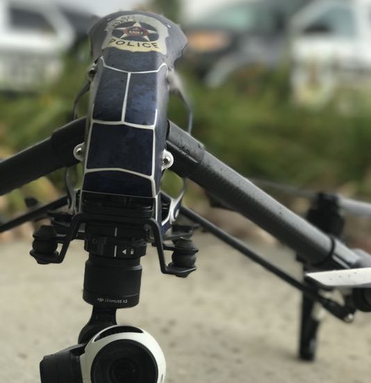
FAA-certified pilots with Fort Collins Police Services deployed a drone to map the 6.5-acre scene of the crash, near the Larimer County Landfill. It was the first time the agency used a drone for a crash investigation.
The unidentified man was traveling north in the 5800 block of South Taft Hill Road Tuesday morning when he drove off the road, crashed through a fence and came to rest about 650 feet from the west side of the roadway, according to an FCPS news release. He will be identified pending autopsy and notification of next of kin. The investigation is ongoing, and police are examining whether he suffered a medical event.
The call for the crash came in about 5:30 a.m., and police investigators periodically closed lanes in the area for four hours following the crash. They also launched the drone.
FCPS, the Larimer County Sheriff’s Office, Loveland and Colorado State University police departments, Poudre Fire Authority, and Loveland Fire Rescue Authority collectively launched a regional unmanned aerial system program in late June to assist in investigations, including serious crashes and backcountry search and rescue operations. The drones can help make crash investigations more efficient and minimize traffic disruptions, according to FCPS.
The six participating agencies have a total of five drones, and each agency has a group of FAA-certified pilots. They’ve outlined polices, procedures, and privacy and safety information on larimeruas.com. Anyone with questions or comments about the team can also submit feedback there.