4 Reasons Drones will Revolutionize Accident Scene Response
- May 26, 2016
- Posted by: Drew Jurkofsky
- Category: Blog

Orlando, Florida. Google “drones and law enforcement” and words like “surveillance,” “apprehend,” and “crime fighting” pop up on the search feed, reflecting a still-present association of law enforcement with military drone usage. A bit less prominent is drone (or UAV) use for accident reconstruction, an area with huge potential for law enforcement to quickly and accurately document vehicle accident scenes: especially pertinent when there is large loss of property or life. Images and photogrammetry software are already successfully being used to document these scenes, but drones offer significant benefits to the workflow:
1.Drones make documenting accident scenes dramatically faster.
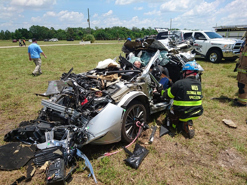
When an accident occurs, it’s in everyone’s best interest to clear the area ASAP, but the scene must be documented first.
“When you look at the conventional methods, you’re looking at time,” says James Addison, a forensic reconstructionist in the private sector and retired police lieutenant. “You’re under a lot of pressure…To have a freeway closed for 5 or 6 hours to investigate a scene creates a lot of tension.”
The most common ways accident responders currently document sites are with laser scanners, total stations, and photography, or a mixture of the three to gather measurable data and produce a 3D point cloud of the site. These methods, however, can take a large amount of time and require personnel trained in surveying, who may not always be on hand when an accident occurs. Drones can easily cover larger distances for faster coverage: the larger the accident area, the better the efficiency of a drone to collect the data.
In a study by Unmanned Experts, Drew Jurkofsky, a Colorado police officer and accident reconstructionist with nearly 20 years experience, found that
Using a drone for accident documentation instead of traditional methods cut time spent in the roadway to nearly one fifth, and measuring time to around one third.
2.By reducing time spent on site they lower human and financial costs.
Closing roads or reducing traffic flow in order to document a site is not only financially costly to responders and drivers in time and economic costs, but also puts lives in danger.
According to the Federal Highway Administration (FHWA), every minute an accident continues to be a hazard increases the chance of additional accidents by 2.8 percent.
Traffic related fatalities are consistently a leading cause of officer death, states Jurkofsky, and this risk is reduced both by lowering the amount of time law enforcement and reconstructionists spend gathering data on site and their exposure to traffic.
By deploying drones as a tool to clean up accidents more quickly, says Steve McKinzie, CEO of an accident investigation and reconstruction firm, “We cut the economic loss of communities where critical highway incidences occur, we improve the safety of the working environment of the first responders, policemen, firefighters and EMS, and we reduce the secondary collisions.”
3.Their measurable outputs provide evidence to show in court.
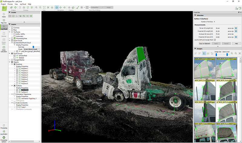
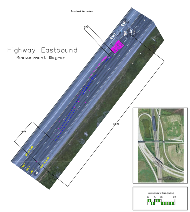
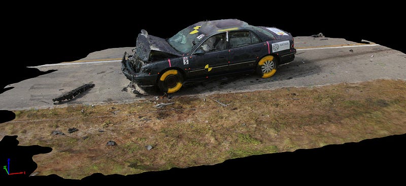
The goal of data collection is to produce a reliable diagram that can be shown in court, ultimately to determine the cause of the accident. Image data collected in just one drone flight can be used by photogrammetry software like Pix4Dmapper Pro to produce a 3D point cloud, model, measurable orthomosaic and detailed report.
“You have a two fold purpose with UAVs,” said Addison. “You can get the point cloud data and use it to take measurements and recreate the scene in 3D, then you still have the photos to present as evidence themselves or to render into a scaled, aerial view orthomosaic as a diagram.”
Even more important than producing a model that helps describe an accident scene to a jury, is having measurable data: the unofficial and approximate accuracy standard being 2–5 cm, though this varies depending on case needs.
“From a scientific process, you’re not so worried about visualizing the data, as you are being able to analyze the data,” said McKinzie, who emphasizes the importance of being able to measure distance and angles of a site. ”We always come back to this issue of how and why an incidence occurred. And if we can’t answer the how and the why it occurred, we can never prevent a similar instance from occurring.”
4.They make data collection easier, meaning less training required and broader accessibility.
With increasingly automated drone flight planners, such as Pix4Dcapture, and photogrammetry software, like Pix4Dmapper, less specialization is needed to accurately document an accident scene. Not only is the workflow less invasive, it is ideal in situations with extreme time, personnel or equipment restrictions.
Drone image acquisition does not have the same sensitivity to obstacle occlusions or moving objects that laser scanning and total station methods do, making a complete and clean model easier to acquire. Reconstructing imagery in Pix4D software is not camera restrictive either, meaning any camera on hand can be used to collect data from an accident. It’s even possible to use video from a smartphone, which the software uses to extract still frames from.
Far from being an unsafe, invasive or violent tool in the hands of law enforcement, drones and photogrammetry software are likely to become a standard part of the toolkit for surveying accident scenes. Their use has proven benefits and potential to revolutionize the way we deal with vehicle crashes.